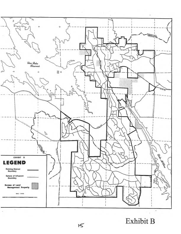
The map below was produced by the Mariposa County Planning Department to depict the "Sphere of Influence", or areas where LDPCSD services may be needed in the future. This map does not show the actual current LDPCSD boundaries.
LDPCSD Sphere of Influence and Boundaries
The map above was produced by the Mariposa County Local Agency Formation Commission (LAFCO) and shows the boundaries of the LDPCSD and Sphere of Influence.
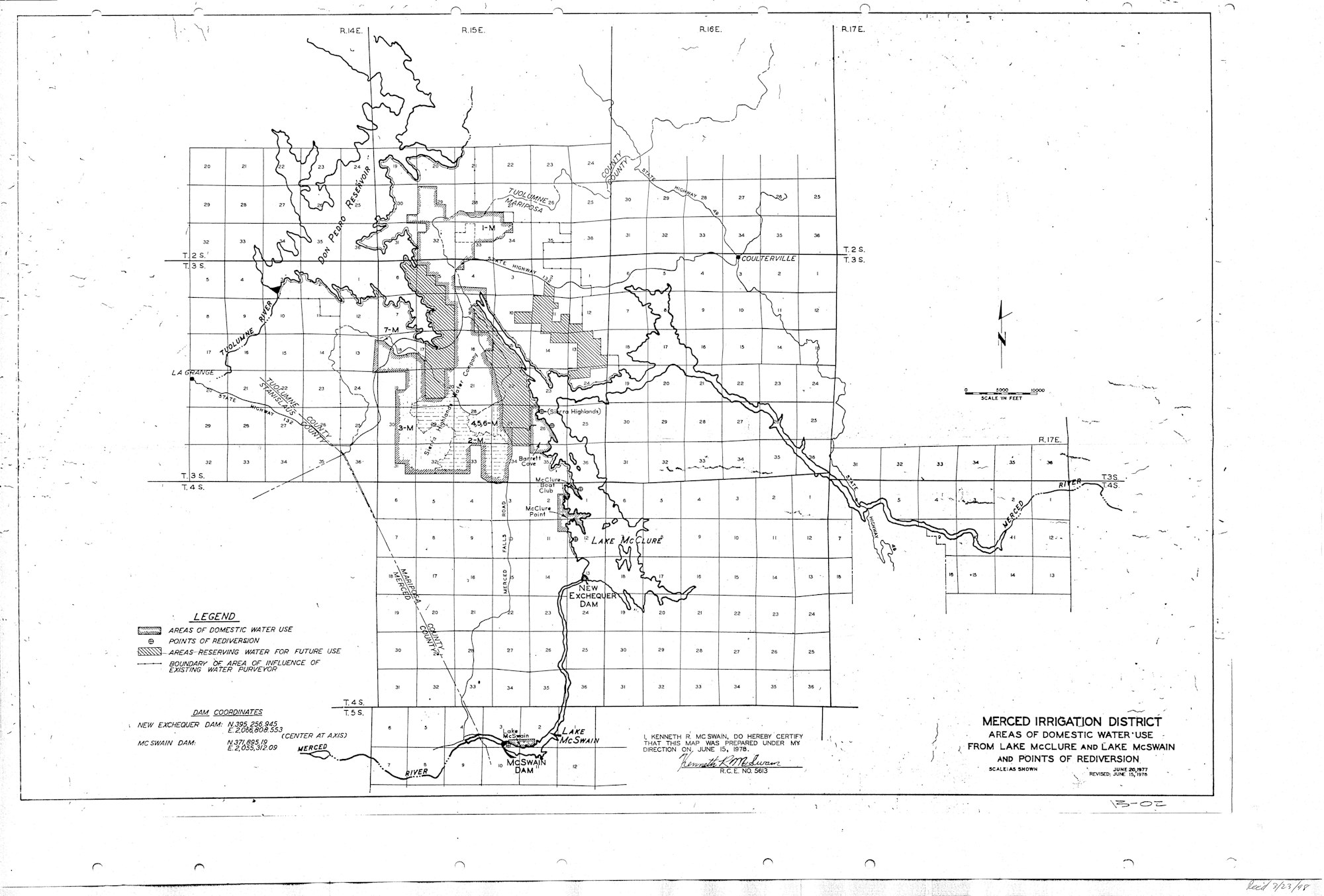
Merced Irrigation District Place of Use Map - (State Water Board Regulated)
Place of Use Map
Search results
Website Accessibility Policy
Lake Don Pedro Community Services District is fully committed to providing accessible facilities, elements and
channels of communication to all members of the public. As part of this commitment, Lake Don Pedro Community Services District
has a policy of providing an accessible website compatible with the Web Content Accessibility Guidelines (WCAG 2.1) and
commercial screen reading software. All features of the website are coded to allow individuals with vision and
other impairments to understand and use the website to the same degree as someone without disabilities. We welcome
feedback and can often resolve issues in a timely manner if they arise.
If you need any special assistance or accommodations:
Lake Don Pedro Community Services District has designated a compliance officer for website disability-related accommodations.
The compliance officer has received training in website accessibility and updates the site in accordance with those best
practices. Contact our accessibility officer to report an issue.
Compliance Procedures and Reports
In addition to testing with users with a wide range of disabilities and coding our website to WCAG standards,
Lake Don Pedro Community Services District regularly scans its website to ensure ongoing compliance, and makes timely
changes to any inaccessible changes, if any are found.
Linked Documents and Third Parties
Please note that this site may link out to third-party websites, such as state or federal agencies, that do
not have accessible content. This site may also include documents provided by third parties included in our
agenda packets, for example. While we cannot control the accessibility of content provided by third parties,
we are happy to assist any member of the public with reading and accessing content on our site.